Sundog Weather
January 2016 Mid-Atlantic Blizzard
Our Conclusion
The Mid-Atlantic Blizzard of January 2016 was a very unpredictable and impactful storm. Due to the numerical models utterly failing to forecast the Northern impact area, dopplar radar remained the best forecasting tool as the storm continued to worsen.
Radar & Nowcasting
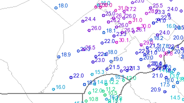
During this Blizzard, mesoscale banding led to dramatic gradients in Snowfall Accumulations across Chester County. Overall, we found that radar products were the most helpful in determining the worst impacted areas.
Storm Total Precipitation (Dual-pol)
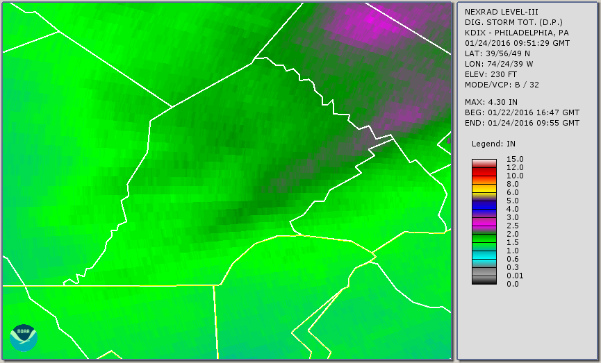
NOAA, 2016
Storm Total Precipitation (Legacy)
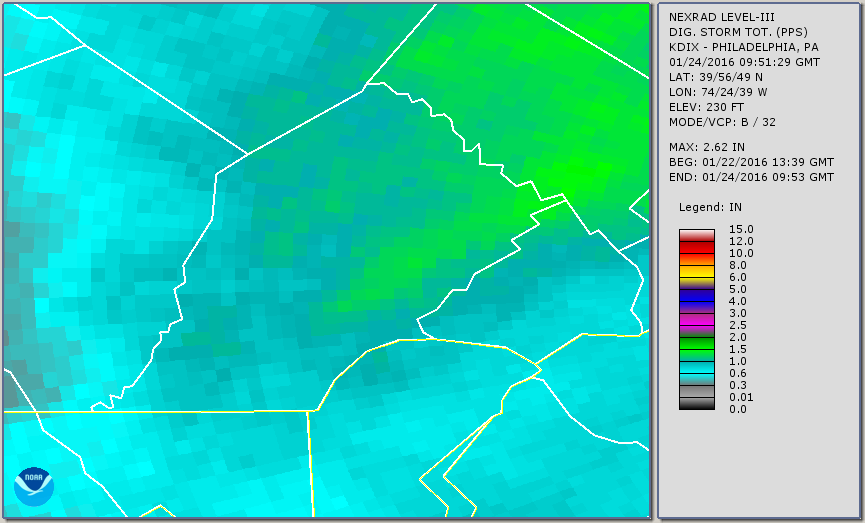
NOAA, 2016
Snowfall Reports